Kibera Emerging

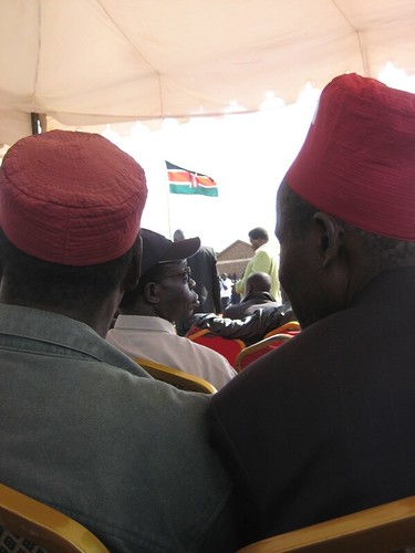
We’re now on our third week out mapping Kibera. Our group of intrepid explorers has had two weeks out mapping their neighborhood and uploading and editing their map data in the computer lab . They have been quite patient and dedicated to the task of learning new computer software, and we’ve pretty much brought the Sodnet offices to maximum computing capacity. Thankfully, we have five technical volunteers who are helping them learn the OpenStreetMap program, upload data, and scan in their paper maps.

We’ve now changed our schedule to accommodate the extra time – and focus — needed in the computer lab – spending one full day in the lab, then one full day in Kibera mapping and discussing our progress.

Here in the lab, we’ve found that computers are funny partners for those who weren’t brought up on Windows, much less Facebook (though we’re proudly starting a Facebook group!). There is the whole problem of click-and-drag, of click versus double-click, of opening and finding something in a web browser as opposed to a folder or flash drive, of typing web addresses precisely and passwords with proper capitalization (common practice is to flick on caps lock instead of shift). The use of a computer is not actually as intuitive as I had come to think. Certainly the keyboard, with its shift and control keys and illogical location of the letters, is not a straightforward tool. A few times, I have been reminded of how I painstakingly studied typing in grade school via a little computer program called Mavis Beacon Teaches Typing. Thanks Mavis! Wish I had a copy for our participants now.

But the fact is, after just three days in the lab and two days in the field, we have quite an impressive amount of marks on the Kibera map. It’s starting to not only resemble other urban areas with churches, schools, and public toilets marked in abundance, but also to reveal the astounding density of the place. After the second day out mapping, we took just five of the villages and had the mappers tally the features they recorded. Here’s the impressive list they made:Tally of mapping day 2

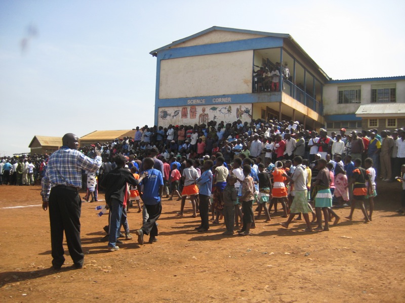
I spent Friday morning walking around the village of Raila with Regynnah, one of the mappers, tripping up the dirt pathways alongside trenches filled with running waste water, past small kiosks selling soda and cell phone top-up cards and toddlers chanting in unison “how-are-you!” We stopped at a few pre-primary schools – they seem abundant – and were treated to a little dance and song at one of them.

We toured a toilet facility under construction, and marked an AIDS clinic, chapatti shop, a cobbler. The sheer amount of potential landmarks led me to wonder what everyone had decided was important to map, and we came to a kind of consensus after making that list on the whiteboard. Then underlined features are essential to map, the rest are up to individual discretion.

So the next challenge on our plate is to help build bridges to make use of the information and demonstrate where it fits in to the bigger picture. We’re bringing in various speakers to Kibera to share some of the possibilities for this kind of mapping and introduce the participants to the wider world of technology. So I would say our ambitions are high – it’s a matter of not only teaching computer skills but envisioning the mappers as eventual full participants in the global wired world.

Ready-set-go!

IMG_4614.JPG

I really wish I knew Swahili. Sitting in the hot sun listening to speeches by every manner of councilor and administrator, including what were apparently fiery political diatribes, some basic Swahili might have kept us there just long enough to hear Prime Minister Raila Odinga himself give a speech. In fact, we’d thought we were going to actually get a chance to meet the PM ourselves, since the Area Chief of Sarangombe – now a fan of Map Kibera – had indicated as much. But this didn’t seem remotely possible once we were sitting in the Olympic primary school grounds at a fundraiser, surrounded by crowds of Kiberans and various suited men and brightly-dressed women. Oh, well. We’re never quite certain of anything until it actually materializes.

But things have materialized, right in front of ours eyes, time and again. On Friday, I showed up at the Ngong Hills Hotel at the invitation of our new friend Kepha, not sure exactly what I was there for. It turned out to be a forum organized by the Moraa New Hope Foundation, where approximately 40 people in various influential positions in Kibera and the Nairobi media discussed how to improve coverage of Kibera. Community leaders complained that some reporters asked for handouts in exchange for coverage; reporters tried to defend their coverage by explaining how something becomes “news”; community journalists (our friends at Pamoja FM and the Kibera Journal) pointed out their vital role as a non-commercial source of local information. It was right in line with our efforts to develop community-generated information sources through Map Kibera. It was clear to me that Kibera residents are tired of being seen negatively, while outsiders want more nuanced information. Hopefully Map Kibera can fill part of the gap between the local self-representation and national and international perception.
IMG_4591.JPG
In fact, I’ve hardly ever seen such a vibrant, active place as this slum. On Saturday, the streets of Kibera teemed with life – cars covered in ribbons for a wedding party, church groups headed out in matching outfits for service projects, young kids playing football, everyone out shopping or selling, CD kiosks filling the air with music, brightly outfitted music and dance groups getting ready for the PM’s visit. Mikel and I hung around drinking sodas and taking in the scene. It was nice to see kids running about and a general levity that we were told is in sharp contrast to the post-election violence of 2007 and early 2008 – which people mention frequently in conversation, the scars obviously not yet healed.

There seems to be no limit to the energy of Kiberans working as civil servants and community workers, even while plenty others that we have not met are causing the trouble that they seek to remedy. Even our young candidates for the mapping plainly admit that other youths are not so civic-minded, more than one indicating that they wanted to volunteer because “idle hands are the devil’s playthings.” It was difficult to say no to any of them. These are high school graduates, some with college too, in a place where the opportunities don’t measure up to their talents. In fact, we’ve been rather overwhelmed with their interest. And I had worried that the time commitment would be an issue.

The bigger issue might be that for many of them, their computer skills are quite basic. The principal benefit of the project for these participants may turn out to be increased computer literacy – a valid objective in itself. Luckily we’ll have some tech volunteers to help out in the computer lab.

We’ve also invited some video reporters to participate from a group called Kibera Worldwide. They will be gathering stories alongside the mappers, which will provide further illustration of the place from the point of view of the residents. My hope is that this can further blossom into a map-based platform to connect local community media to the rest of Nairobi and the rest of the world. So the meeting with the PM might never happen, but I’d be satisfied with the respect of the average Kibera resident.

Plantings

There is really no way to know quite what to expect in advance when you’ve entered a new culture. Even operating in English, signals are uninterpretable, people hard to read, and I sometimes feel that all the prior preparation was just a roundup of possibilities, like spreading a batch of unidentified mixed seeds. One of the delights and trials of the project so far is watching what actually sprouts. And every time something does, I think Mikel or I visibly breathe a sigh of relief, half expecting that here on the other side of the world seeds require something other than water to grow.

Take the pot of lentils. We bought what seemed to be ordinary yellow lentils (labeled dahl) at the grocery store, along with an Indian spice mix. After following the directions on the spice package to the letter, we waited for the lentils to cook. And cook they did, for 30 minutes, one hour, and more, but they remained stubbornly like little stones, completely inedible. Finally, hungry and irritated, we had to make alternate dinner plans. We soaked them overnight and tried again the next day. After that failed, I kept them for two more days in water before finally admitting defeat. And it’s not as though I haven’t cooked dahl – what, thirty times? fifty times? The mystery of the stone lentils remains unsolved. You see –though you’ve always known B to follow A, there’s still a good chance it won’t.

Which is probably why, Saturday morning, we were a bit reluctant heading off to the Carolina for Kibera offices to interview our final few candidates for the mapping trainee slots. Would they actually be there at 10 a.m. on a Saturday? Lacking a confirmation SMS from the office, we were a little unsure. It turns out we should have had more faith – in fact, three young men had patiently waited since arriving early, at 9 a.m. And now (this is probably burying the lead) we’ve made our final selection and have 13 great participants from every village of Kibera ready to start training tomorrow.

There is a general sense of cross-your-fingers and hope things turn out. Part of this is because we Americans are so used to having electronic confirmation – email, text message — of every transaction that it is almost like we’re letting everyone off the hook. It’s no longer enough to give your word, so we don’t feel the need to keep ours. If you say on Monday that you’ll meet on Thursday at 5, better check in once or twice to confirm that. It doesn’t seem to work that way here, where technologies are newer and differently used. In fact, only face time seems to really count – and email is just an add-on, something extra.

Not to say a spoken plan is gold, but it does seem that when one thing falls through, something else comes up in its place, which makes this a pretty thrilling place to work. The training that will start this week won’t be like we expected, but there are sure to be more unexpected sproutings.

“Well, actually it’s not rocket science!”

Levis said with visible relief after we’d marked the location of Big Five Tours on Khapta road, explaining to yet another set of curious security guards what we were up to. Clearly, he’d been genuinely afraid after the morning’s workshop. Having run out of batteries almost immediately out of the gate, in both my GPS and my digital camera, I can’t say I fared too well in the trial-run mapping party. But we managed to get a group of Danish students working on climate change advocacy really excited about mapping, and most of them returned with long tracks and careful notation. So far, so good.

It’s been a whirlwind week here in Nairobi. As I write, Mikel is making an impromptu presentation of the project for members of Pamoja Trust, one of the most well-known and respected community organizations working in Kibera. And yesterday we spent the whole day at MS ActionAid Kenya, where the Danish students were introduced to mapping techniques along with several others from organizations as diverse as Ushahidi, UNICEF, Umande Trust, and World Bike. We actually walked around with the GPS units in the Westlands neighborhood. This was also great practice for those of us who will be working on the project but aren’t exactly fully versed in the technical aspects of mapping, shall we say.

There have been so many helpful yet challenging conversations with groups on the ground here in Nairobi that my head is now spinning. Kipp and Phillip from a group called Sodnet have offered us advice and also precious office space, just out of a sense of cameraderie and shared goals. On Tuesday, we went down to Kibera and trekked around in the mud before we found Carolina for Kibera’s office, where we talked to Kenny about practical details and some practical realities. Out of this conversation, we now have a game plan for recruiting local youth as well as an all-important meeting with the village chiefs next week for their blessing. Around every corner, it seems, is another person offering support and advice, and every time there are unexpected connections that vouch for the shrinking globe.

One emerging theme in our discussions with various community organizations and international development folks is that the collection of map data can be perceived in many different ways. We certainly won’t be the first to collect information from the citizens in this highly targeted neighborhood, and even if the data doesn’t require talking to anyone (we’re recording visible features, not demographics), the very process will mean talking to everyone. What is the information being collected for, and what will it bring with it? Usually, such surveying is done in anticipation of a government relocation, or slum upgrading program, or a new water scheme, or a sewage project, or, currently, a plan to move people who live too close to the railroad line. It may be difficult to impart what seems obvious to those who conceived of a project like OpenStreetMap – that it’s by and for the people, it’s unowned, another way to move control of information into the public domain and into public hands. In this vein, we’re involving community groups who work on media and technology here since they have already worked on some of the same goals. Community media – TV, radio, film – has made major inroads through some truly amazing projects like Carolina for Kibera’s work with Flip cameras, local newspaper Kibera Journal, and Pamoja FM’s radio outreach. It’s exciting to see that when it comes to journalism, storytelling and reporting is already in the hands of citizens themselves. If all goes well, we’ll be able to produce some interesting media together. Stay tuned.

First Impressions

Having arrived two full days late to Nairobi, we’ve now started to adjust to the new surroundings with the help of our kind host, Adriel, local partner Levis, and Phillip and Kipp from Sodnet, an NGO here in Nairobi that promises to be a great resource for Map Kibera. Thanks to these four, we’ve had quite a pleasant introduction to a city that is known abroad mostly for its crime, traffic, and as an unpleasant but necessary stopover on the way to your safari. So far, I’m more impressed with Nairobi’s greenery, wealth, and ultramodern conveniences than its after-dark dangers, and hopefully it will stay that way.

Just a couple of things that surprised me about Nairobi, as a first-time visitor. First off: mobile money. I might have known that mobile banking was well established in Kenya thanks to the Economist article a few weeks back, which I read carefully on the plane. I knew that in Kenya and several other African countries, money could be deposited into your cell phone account and sent via text message to a vendor or individual, who would then be able to access it and cash it out as they like. What I didn’t realize was quite how ubiquitous it would be.  M-Pesa I learned that you could send money to almost anyone, including the cop pressing you for a bribe. We were even told muggers might demand your M-Pesa account before your wallet. But as soon as you transfer the money, a receipt with the name of the recipient appears on your phone, so wouldn’t that seem to be a hindrance? But convenient, in any case. You can even withdraw mobile money from ATMs. Is this the end of bank branches? The next frontier of finance? Seems like it to me. And my favorite part about it is that it developed naturally as people experimented with sending phone minutes back home via text in lieu of cash remittances. So far, I’m a big fan – and I wonder, why don’t we have this in the US? We’re so backwards with all our “cash” (OK, so I haven’t actually tried this mobile banking thing yet, so I might have to eat my words – we’ll see).

What else? The Nakumatt superstores. Now, as opposed to mobile banking, which really has the potential to benefit poorer customers (as a way to safely store and use money without a bank account, for starters), Nakumatt is a brand designed for the wealthier Kenyans. Like a jazzier, more appealing Walmart, Nakumatt stores are enormous and carry nearly everything under the sun. Only, the grocery store is front and center, and the variety and quality of food there is amazing. There are flashy TV screens near the register to “entertain” you in line, and – get this – the place is open 24 hours. Apparently Kenyans will sometimes shop very late at night in order to avoid the horrendous traffic in the city, we were told. I cannot think of a 24-hour everything store that is open all night in New York or anywhere else I’ve lived. Shopping there felt like stepping into the future.

Now, all this might belie the fact that we’re staying in a quite posh area known as Hurlingham. Filled with enormous glassy new construction apartment complexes with elaborate security systems and right next to State House Road, tree-lined boulevard of embassies and the abode of the president himself, the area is hardly home to the hoi-polloi. However, more than most “developing country” cities I’ve visited, this type of wealth seems spread around the city and suburbs rather than relegated to one gated enclave. In other words, middle and upper class Kenyans seem to dominate a fair amount of the city. All this provides a certain context, and contrast, to the Kibera slum that we will be working in quite soon. Just after shopping at Nakumatt, grocer to the stars, we drove along the edge of Kibera past tiny corrugated-iron shacks sufficing for storefronts. The same kinds of goods could be bought there that we found at the superstore – vegetables, electronics, housewares, cell phone cards – but the shopping experience could not be more different. I hope that this contrast in culture can be illustrated, hinted at, in our map. It will certainly be on display here on the blog.

Welcome

I guess it takes a great excuse like “I’m headed to Africa and don’t really know what’s next” to actually get a blog up and running. Ah, so many great blogs have originated that way! I had been *meaning* to start up a blog, or maybe start writing again on the one I left behind three years ago…but writing about my day to day life in New York or San Francisco or DC seemed just so very ordinary.

I’ll be focusing here on development in Africa, and wherever else my travels may take me. And as a media — shall we say, enthusiast? — as someone who ends up documenting, writing about, recording, filming, and generally analyzing and mediating the world around them in the natural course of living, and thinking about others who do the same, I’ll be writing a fair amount about media here too. This is my current research – to know as much as I can about all the fascinating new developments in journalism, storytelling, communication, and information sharing that are happening here in Africa and throughout the developing world. And to think about how this relates to development as a practice.

I hope to write some fun stuff about elephants or whatever, too.

I’m not sure what else I’ll cover along the way, but initially I’m going to crosspost on www.mapkibera.org, a project I’m working on in Nairobi with Mikel Maron (who is my partner in most things). The project is to create a map with residents of Kibera, a massive slum in Nairobi, which will be freely available public data afterward, accessible through OpenStreetMap and elsewhere. The whole process of creating the map will be documented here, and also I’ll be looking for the intersections with development goals like empowerment, local ownership and participation, social change, access to resources, and whatever else comes up.