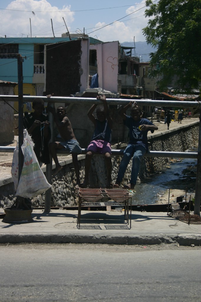
On citizen engagement and “feedback loops”

Citizen feedback on development and aid projects has been a kind of “holy grail” for aid for a few years now. The latest discussion comes in a recent blog post, “Consumer Reports for Aid“, by Dennis Whittle of the Center for Global Development. This is one of my very favorite topics, too. And, I eagerly sought the same kind of thing in 2009 when we began working in the Kibera community.

But here’s why we might be awaiting such feedback loops – in the model of Yelp or Consumer Reports – until the cows come home, dedicated hackathons notwithstanding.

When we tried to activate a citizen feedback loop in Kibera with Map Kibera, we thought that having a communication mechanism for residents to post comments about aid projects on the ground could revolutionize the way not only NGOs practiced, but the way the community viewed and took ownership over development. On Yelp, if I leave feedback, either positive or negative, I feel more connected to the businesses in my community and helping them succeed, fail or improve. In short, I feel a subtle sense of ownership. If the local NGOs and projects in a place like Kibera could be put online and rated by citizens, or various services commented upon in a detailed way, then maybe we’d have some real and meaningful feedback. USAID and big donors would respond to that, not to some puffed up self-reporting.

In fact, when we launched Voice of Kibera, that was one of the first ideas we had about what it might become. It wouldn’t necessarily be the news reporting site we have now; maybe it would allow people to mark services and organizations and comment on them.

It’s clear to me now why that didn’t happen – though, as you’ll see, we’re still working on the broader goal.

1) It’s hard to overestimate the complexity of a neighborhood of some 200,000 citizens, several tribes, a variety of languages, and little government whatsoever, that has existed in spite of the government’s desire to wipe it out and whose often transient residents have to struggle every day to make a living. I’m talking about one place, but I might be referring to many urban informal or extremely poor neighborhoods in the world which are the target of large amounts of aid dollars. There is a way things get done, and a reason why they get done that way – an entrenched system in which both the aid donors, government, and local actors play a role. People are very sensitive to the micropolitics that could impact their lives much more seriously than in wealthier environments. Offending the wrong person, or pleasing the right one is an important determinant of success.

Being in the business of engaging people, soliciting and publicizing their honest and informed views, and getting accurate data out there is a big job, and in my view far too little attention is being focused by techies or donors on the community side of this equation. Ultimately that’s what Map Kibera seeks to do, but it takes a lot more than setting up a web platform.

In this context, the role of a trusted representative is very important – who represents local opinion? Is it just whoever gets on Twitter while their neighbors still don’t have a mobile phone? In our excitement over technology there are always those who figure this out and can then hijack the process. System gaming problem? Not solved.

2) International aid is a mainstay of the Kibera and many other poor communities’ economies. This is what the international aid juggernaut has wrought. Yes, most Kiberans work outside of the aid industry and its various projects, but were you to do a critical analysis of the local economy and jobs, you would find that NGO jobs are the best paid and most stable, and come with a reputation upgrade, while “appreciations” – a soda at the end of a meeting, or a bit of airtime, cash or t-shirts – will be given out to a myriad of community members who attend any sort of event or meeting. Therefore, how do you build loyalty and good ratings on your Development Yelp? By intelligently executing a project that everyone relies upon day to day, that has impact, and legitimate sustainability (meaning the NGO jobs “should” be phased out eventually)? Or by winning a popularity contest by fitting the expectations for other perks? It’s a lot easier to do the latter. The incentives and potential rewards for supporting a claim that an NGO is doing great work are very high. Saying something negative can get you in trouble. We’re talking about tight-knit communities here. Why spend time giving critical feedback when it’s potentially going to get you in trouble?

3) In fact, why spend time giving feedback at all? Time and energy are very precious resources when you live in a place where parents are forced to leave small children to play unsupervised all day because they need to work and can’t pay for daycare. You’ll need to distribute some appreciation to get participation, unless participants are using a system for rating large-donor projects they’ve been beneficiaries of (see Danish Refugee Council example below), in which case much of the feedback might be in the form of calling out the continuing need for more assistance.

4) Many might respond that anonymizing this information will solve some of the problems I’ve mentioned. That’s essentially the route that Global Giving went with most of the stories on its Storytelling platform. But in that case, you don’t have very detailed knowledge about specific interventions or programs, which to me is the ultimate goal. Also, in most instances, asking for anonymous information from people is perhaps the purest yet least effective method of crowdsourcing. Anonymous inputs means you cannot hold people accountable for false information, and also removes a key incentive – to have an online presence and visibility. Even with Yelp, that’s clearly a motivator – a little bit of egotism.

So how do you make visible the inherent knowledge in a community of what works and what doesn’t? Certainly every Kibera resident has a lot of valuable knowledge, that, for instance, the vaunted bio-toilet is just stinking up the corner and no one’s using its supposed cooking gas. There is indeed a desire in Kibera, at least, to weed out the unproductive and even fake “briefcase” or “ghost” organizations that are supposed to reside there, but which aren’t in evidence on the ground, which means there is some latent incentive to provide data.

That’s why we hope our teams on the ground at Map Kibera and others like them will become the trusted informational resource for the community and will do a kind of due diligence on the local organizations and projects. In fact, this is a standard role that journalists play in a community – accountability and investigation. New kinds of citizen journalists and information centers can fill this role in places where there is limited news coverage. These informants aren’t anonymous at all – but they are protected by association with a network and local reputation.

In fact, an idea the Map Kibera team had was to create a directory of organizations and projects in the area where each group could have a page explaining what they do. The neutral nature of this project would invite in organizations in order to allow people to know who’s doing what where, and basic transparency would be built in. It would also help those tiny initiatives of regular community members – the orphanages, day cares, and youth groups – without much money or tech savvy to have some visibility and essentially prove their value. Mikel and I worked on this a little bit in a different format with Grassroots Jerusalem at www.grassrootsalquds.com. We are still seeking funding to finish this platform and establish it in Nairobi. Once that’s done, I think we can rely on our dedicated team to fact-check reports and post about various initiatives, and because they’re trusted members of the community, they can retrieve detailed opinions of citizens, both positive and negative and quote them on the site.

There is another way this could all work, which is to create a loop about government and large donor projects (those less likely to have a presence in the community) or simply highlight needs that require attention locally. This is more akin to the FixMyStreet concept, calling out local issues which have no project yet attached in hopes of triggering government or other support. We’ve tried to do this in Tandale, a slum in Dar es Salaam. There, we trained a team of reporters who’ve mapped the area and now post blog reports about conditions in the slum. See http://tandale.ramanitanzania.org/blog/. In this case, the loop has so far failed to close on the government or other responder’s side, in spite of initial promise. Here is where an influential third party can play an important role, such as the World Bank or UN.

I also found interesting this example of the Danish Refugee Council trying to solicit feedback on its work, which might not be a model to copy but gives a pretty accurate picture of what types of complaints a system might field. This is what a loop would often amount to: “We are requesting for power to charge our mobile phones, in order to reduce the challenges about the power and sent more SMS feedback.” Response: “According to your prioritization, DRC doesn’t provide electricity to any community.” Basically, that’s a no. I’m not sure that gets us much further, yet, than fielding such requests for more assistance. But, it does make public a normally very private exchange between donors and beneficiaries, when they are in that traditional relationship common to development schemes. I think this is a step in the right direction, because the more we open up these processes the more likely they will be open for questioning and productive critique.

The fact is that every “complaint” about “service delivery” is actually a citizen claiming a right – clean water, for instance – often in a place where there is no easy solution and there is a systemic and ultimately, political reason why neither NGOs nor government have yet to provide for such needs. Usually, that reason has little to do with the government (or big NGO/World Bank/UN etc) not knowing that the problem exists, sometimes in great detail.

The more that trustworthy community information representatives can detail and report and map and publicize and pressure and comment – and, do real journalism about – about the particular issue, the more likely that some downward accountability will be injected into the system. It’s also more likely that community members will begin to understand the forces at work in their neighborhoods and analyze what’s happening around them. It’s hard to imagine an information asymmetry as critical to address as that between residents of poor communities and major players in the development and government arenas, the 6 foot view vs the 30,000 foot.
Dar es Salaam: Tandale and beyond

This post also appears on the GroundTruth Initiative blog.

GroundTruth recently returned from a trip that included a lovely stop in Dar es Salaam, Tanzania.

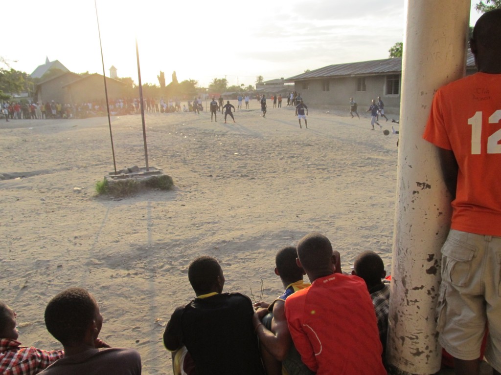
Football at sunset in Tandale

Last year, the World Bank and Twaweza sponsored a brief mapping pilot there which was completed by GroundTruth in partnership with Map Kibera Trust. On the community side, the pilot involved a partnership with a local associate of Slumdwellers International known as the Center for Community Initiatives. The Tandale mapping exercise, while successful in many ways, unfortunately did not continue beyond the pilot month as hoped. This was partly due to the unfortunate destruction of all of the mapping and computer equipment in the massive floods of December 2011.

We were therefore excited to be able to return this June, again in partnership with the World Bank, and take a look at the successes and failures of the pilot and possibilities for growth in Dar.

While the mapping process initiated last year was very much based on the Map Kibera work in Kenya – for example, training community members to do their own mapping and involving the community in forums to share ideas and results, there was also a new element: involving University students. We made a point of engaging the Ardhi University students of Urban Planning in such a way that they were learning alongside an equal number of residents of Tandale, exchanging knowledge and learning about the issues in Tandale. It was a great practical experience for students. Meanwhile, Tandale residents appeared to appreciate the attention from students and their help in getting the important local issues mapped and recognized.

During our recent trip, it was clear that for some students, the relationship with the Tandale community leaders (and the multiple challenges they face in areas like sanitation, wastewater management, infrastructure, and more) had made a strong impression. A few students had continued to talk to some of the residents and try to find ways to support their continued work, without institutional support but purely under their own initiative. This was encouraging, and a great signal of success or potential success. One student, Msilikale Msilanga, had even returned to Tandale several times and made reports via both email and on the Tandale Blog about various emerging concerns.

Part of our enthusiasm to return to Dar was therefore to help Msilikale and other motivated students to continue to support the most motivated community members and build off the ground work laid last year. GroundTruth brought some new equipment (partly donated generously by Development Seed) to support this goal.

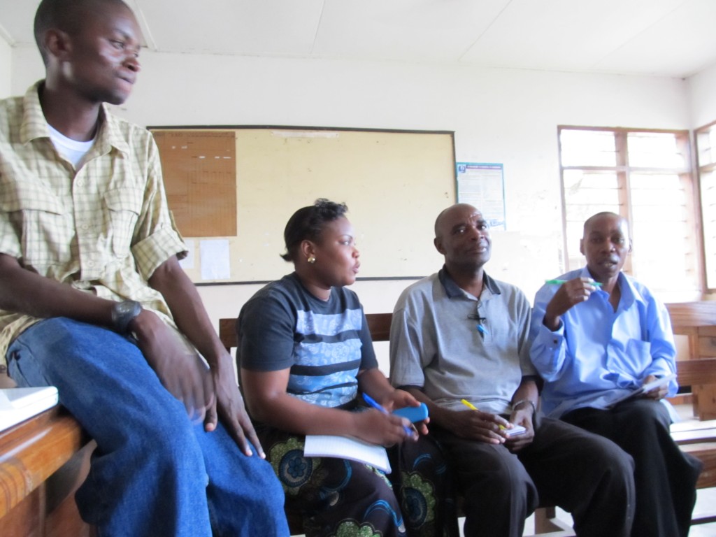
Msilikale with Tandale participants

One of the first things I did was to visit Tandale and ask the participants there about their experience last year. Not surprisingly, the main thing they wanted to talk about was the failure to establish a means of accessing any equipment after the pilot. In a place like Tandale, cybercafes are rare or distant. Certainly, accessing something like a GPS or a software like JOSM would not have been possible independently.

I explained (along with Mark Illife, the primary GT trainer last year) that unfortunately Mark had taken very ill and had to leave quickly at the end of the pilot; meanwhile, no suitable location to store equipment had been agreed upon. It might seem like a simple thing: find someone/someplace who can properly care for, house, and monitor access to a few pieces of equipment: laptop, modem, GPS, camera. The truth is, however, it’s not simple at all. In fact, we have spent a great deal of time and effort during and since our trip to resolve this same issue with the new equipment that we brought. We will wait and see if the plan succeeds. The problem is that in Tandale (like other informal settlements in Dar) there are few offices or community-based organizations which might suitably house equipment. The Ward Office was a great host, but it closes around 5 pm and on weekends, when most participants are free. Situating equipment means establishing a close partnership and contractual agreements, which also takes time (and is what we’ve done this time through).

It’s very important to realize that in a community like Tandale, or perhaps any time you are working alongside community members – that is, in a geographically defined area where people are associated together in various ways, and know each other, and face the same problems day to day – it’s not sufficient to simply bring in a “pilot” and then showcase the results without continuity. This is a main premise of Map Kibera as well. One is entering into the lives of people and introducing something in hopes of having lasting impact. I was glad to see that residents were still enthusiastic that the pilot could still lead to something nearly one year later, and that GT was able to find a way to continue.

I then supported Msilikale and two other former Ardhi students in running two new training sessions on reporting using the Tandale blog and Ushahidi instance, Ramani Tandale. These sessions were very exciting. Participants had a LOT to say about their community. We not only introduced technology, but spent a good deal of time coming up with story ideas, thinking about what and how to tell the stories, and writing them out in small groups.

Combining some of the community “elders” – members of the Slumdweller Federation group or other local leaders – with more computer-savvy local youth was very fruitful. The elders had many story ideas, as though they had just been waiting for someone to ask. They finally had a public way to air their grievances and talk about their hard work through the Federation chapter. Meanwhile, the youth could quickly type and pick up the posting skills.

Tandale, it should be mentioned, is really not much like Kibera. The population is smaller and the area is less dense; community leaders work closely together with the Ward Officer and other local political figures; the social problems one finds are less contentious, less likely to involve violence or conflict. The feel is more rural or village. This is my impression, and it tends to extend over the whole of Dar. Dar is no Nairobi, and any program should be adapted to this variation in how things get done. Above all: people rely on, and trust government far more, relatively speaking.

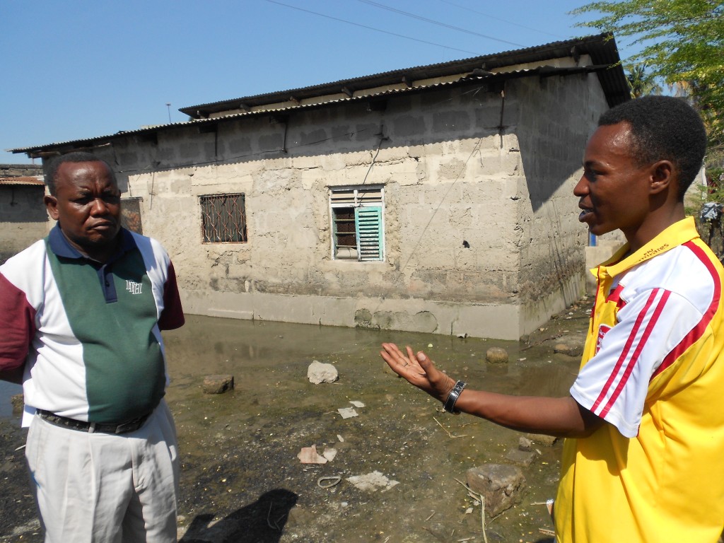
Reginald, an Ardhi student, talks to a resident about a persistent flooding problem
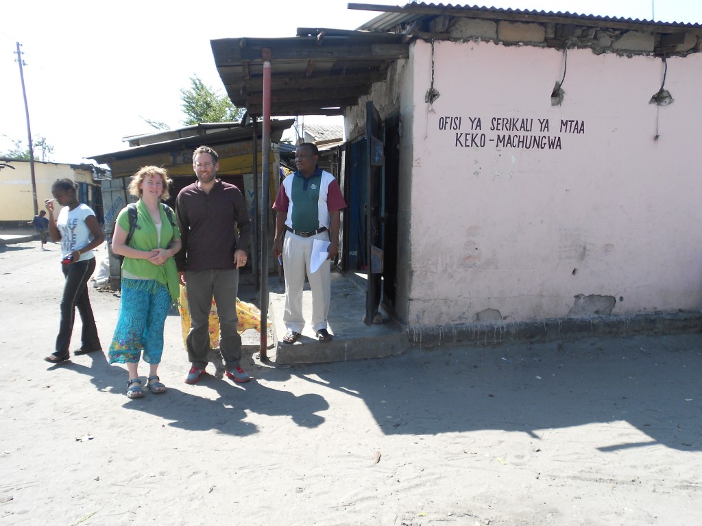
Visiting Keko Machungwa Ward Office

Another exciting development since our work last year was that CCI had already hired one of the Ardhi students to help them produce a similar map in another settlement where they were working, Keko Machungwa. CCI, like others affiliated with Slumdwellers Federation, assists slum residents to collect and use local information to determine their own development needs and find ways to serve them, or to band together and advocate for change. CCI was also excited about the possibilities of local reporting and media to highlight these issues,  so we’ve partnered with them in our recent bid for the Africa News Innovation Challenge. We were glad to see that mapping was actively underway, and local leaders were watching us work on online reporting tools in Tandale. Blogging was in high demand.

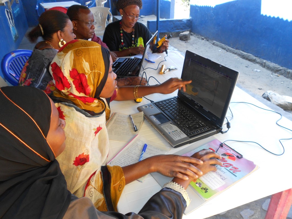
Map Editing in Keko Machungwa

Following up on Tandale was only one reason for the visit. We had also contracted with the World Bank to help advise on the future of mapping and reporting in Dar, especially with regard to the strategy for engaging Universities. We spent a good deal of time meeting with interesting organizations like KINU, a new tech “hub” space and tech entrepreneurship support; TanzICT, a Finnish government support to the Tanzanian government’s  COSTECH ministry; Twaweza, and others.

It was exciting to see that Dar is beginning to get a bit of the Nairobi tech fever, but given its unique culture and social context, the innovations that come out of Tanzania are bound to be different. Those which are adopted will also be uniquely Tanzanian. Anyone who has visited these neighboring countries cannot help but notice the stark difference in cultural “personality”, like two twins who grow up as opposites. Risking a bit of essentialism…I can’t help but think Nairobi is like the athletic, popular and brassy twin, outgoing and ambitious but liable to get into big trouble from time to time, always on the hustle. Dar is the quiet one, thoughtful and introverted, always generous, laid-back and daydreamy.

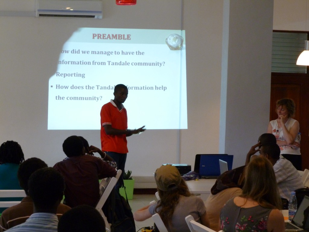
Msilikale presenting Tandale at ANIC event

We witnessed a bit of the differences at an event set up by TanzICT, KINU and COSTECH to publicize the Africa News Innovation Challenge. The event brought together journalists and young software developers to brainstorm some ideas to apply to the challenge. We’ve watched Nairobi’s iHub, now featuring several such events a week, grow up from just an empty space in 2010. Now this new space in Dar has just gotten off its feet. It’s therefore exciting to see what can come of it. I don’t think of this as being “behind” or “lagging” at all, I believe that Dar’s tech scene will certainly have its day and possibly will quietly issue in some of the more effective ICT and media projects and ideas. There are benefits to being just out of the spotlight yet close enough to watch and absorb. Msilikale was able to entertain the crowd with his presentation in Swahili about Tandale, including the new blog posts and Ushahidi posts on Ramani Tandale.


We’re certainly going to keep watching. GroundTruth recently posted an application to ANIC which would bring together Map Kibera and CCI in an exciting new community-based reporting platform designed to meet the needs of both Dar and Nairobi informal settlements. A revolution in networking and raising the voices of slumdwellers is brewing, and we hope to be able to support it in any way we can.


Community Mapping: Frequently Asked Questions

Community Mapping is not a new term, but it seems to be enjoying a makeover due in part to the impact of new citizen-led mapping efforts, like Map Kibera, GroundTruth, and others using OpenStreetMap all over the world. It’s been popping up everywhere lately, so I thought it might be time to look into just what IS community mapping, exactly?

Policy Link reported back in 2002 that:

The terms community mapping and GIS are often used interchangeably. We define community mapping as the entire spectrum of maps created to support social and economic change at the community level, from low-tech, hand-drawn paper maps to high-tech, database driven, internet maps that are dynamic and interactive.

Meanwhile, an organization called Center for Community Mapping uses mostly Google maps to build software and then license it to others to use, with the expressed purpose of “empower(ing) grass-root stakeholders with mapping technology to foster participatory planning, community education, and cooperative organization”.

The first definition above is very broad, and doesn’t say anything about the role of community members themselves; the second does talk about empowerment but does not use open data standards.

Mikel recently presented and posted about this topic, saying “…the excitement of community mapping is beyond the data that’s being created, but the possibility of a fundamental shift in the power dynamics of how development is practiced. If people know the facts about their own lives, they have more power to call to account those institutions which are supposed to serve them, and ultimately, to improve their lives themselves.”

That’s the beginning of our approach. But, to be more explicit, here’s the GroundTruth take…

Frequently Asked Questions about Community Mapping:

Does Community Mapping need to involve the community, in the mapping?

Yes, it does. In the first definition above (the one that equates CM with GIS) it’s more about “mapping of a community” than “community mapping”. To me, that’s just plain mapping. Or perhaps, using GIS to understand a place, which happens to be a particular neighborhood.

Does that community actually have to live in the place where the mapping is happening? Isn’t it enough if they’re from somewhere nearby?

I’d again be pretty strict about that. If it’s called Community Mapping, people should be mapping in their own community, not the one next door. Why? Because we believe this is about participation, and not just about data collection. It’s also about giving people a chance to show what’s happening in their neighborhood from their point of view, in this case through the medium of a map, and about their own use of the information later.

How about if other people map the community and then later involve members of the community in a presentation about the mapping, is that still community mapping?

Not really. It’s just mapping, again, that happens to take place in a community.

Does the community need to own the information collected during the community mapping? Does it have to result in open data?

They don’t need to own it, but we do believe in free and open data as a critical part of community mapping. After all, the point is not to help companies build their commercial base, or to hand over more information to proprietary silos inside NGOs and governments, never to be seen again. The idea is to create a commons of information that can lead to greater transparency from the local level on up, and allow many people to leverage that information.

So, Community Mapping is another way of saying, “the community is actually doing the mapping”. Does that mean they’re using the technical tools themselves? Isn’t that too hard?

In our experience, most people learn quickly to use basic mapping tools, within reason. If students from a nearby university, none of whom live in the community, do the mapping, or if a great local NGO decides to map the local slums, hiring professionals or finding volunteers or using their own staff, none of whom reside in the slums, then that’s not community mapping. If people get their hands on the tools and learn to make the maps (as part of a larger process of participatory planning, information-based advocacy, or other local processes) that’s how we define the CM practice. Yes, we’re going pretty far here in saying that people actually do some technical work rather than perhaps walking around with a more “expert” mapper showing them what is where. There are probably ways that some technical support can be integrated, and certainly not everyone in the community needs to be doing the mapping. But it is part of the premise of OpenStreetMap, that such resources can be created by crowdsourcing, and they make it easy enough to do so.

It’s possible that community mapping can happen without a lot of technical training, though, and using different paper-based integrations (walking papers, etc). Perhaps the key point to make here is, if the goal of your project is explicitly to do community mapping, don’t assume that residents can’t or won’t want to do it themselves. And, as long as your project is done in such a way that prioritizing community empowerment and participation (and check on this carefully; it’s not common), coloring outside the lines of this FAQ is very much encouraged.

If I’m using OpenStreetMap, isn’t that automatically community mapping?

No. It’s great that you are using this user-generated free and open map of the world, though, and thereby contributing to the liberation of data worldwide for generations to come. Please don’t stop. And you might be doing community mapping, but not necessarily.

Is Community Mapping the same as Citizen Mapping?

The name is cleverly different from community mapping. While they could be the same thing, it’s interesting to consider that citizen mapping might imply less of a community-based process, and align more with movements like citizen journalism, imagined to be something done by individuals using their personal mobile devices and things like that. However, in places we’ve worked, that’s not quite how citizen media works either. At this point, I believe the terms can be used interchangeably, and we have definitely used both terms.

Does Community Mapping need to be Open?

I suppose not. But if it’s not, why not? Is it because some of the information collected will endanger a person’s rights in some way, infringing on privacy (household ownership data might)? If not, then yes, it should probably be open. Why? It’s a public good. This might require a fuller debate, but unless the community comes together and decides based on a clear understanding of the implications of free and open vs. private data that they need to restrict access, open should be default.

Does Community Mapping need to involve Citizen/Community Reporting or Media?

It is important to have a well-thought-out means for people that are making maps to use the information and build off of that base. A very effective way to do that is to introduce different kinds of reporting tools. This is because people get excited about their neighborhood and have more to say – the map can’t really finish the job, it’s just the beginning. Also, there’s a story (or several) behind each point of interest. I can imagine there are other ways that people can really engage around what they are seeing and use it, but the point is to go beyond the map somehow and allow people to tell stories with the data. Using something like Ushahidi or basic blogging and citizen journalism to illustrate community perspectives has been exciting in our work – in part because it is not restrictive about what people may want to say about themselves.

Is this the same as Participatory GIS?

Not quite. Participatory methodology should be part of both and PGIS is one of the inspirations for our work; community empowerment is also key to both. Traditionally, though, PGIS is closed and the information gathered in the process not intended to be shared openly (for re-use, etc). Also, that process doesn’t typically impart the technology skills to the participants.

So what exactly IS community mapping? Briefly.

Here’s my shot at the criteria.

1) Community creates/gathers the map data. That is, geographical coordinates alongside any other information (we’ve collected things like number of nurses in the health clinics, all the way to why one mother takes her child all the way to the other side of Kibera to see a doctor and what path she uses to avoid the street thugs).

2) Community also edits the map data themselves, and comes to agreement on the final product.

3) Mapped information is generally shared openly, online, contributing to commons, unless otherwise specified by the community and after a good discussion of the options.

4) Community uses the map afterwards, themselves. This might be the biggest challenge in practice, but there are plenty of people who have been using maps in local development for many years who can support on this point. We recommend introducing storytelling and media around the data through other tools for online expression. The mapping also can be part of a larger participatory development, local planning, or advocacy process.

Is community mapping the easiest/most efficient way to get the map I want?

Not always! In fact, it’s a time-consuming, complicated, logistically challenging, and just plain difficult way of getting a map made. But, getting a truly good map is usually time-consuming and difficult. Don’t forget, it’s the locals who know what and where everything is in the first place. Here you have to distinguish between the tendency to want a quick result, and the actual usefulness of what you want to produce in the long run. The idea with community mapping, when it uses OSM in particular, is that the resulting maps can be easily updated down the road when things inevitably change. You’re investing in creating local skills and a local network of mappers. Of course, you’re also investing in empowering citizens, but even if you just want your map this is a good way to make sure that the map isn’t useless in five years.

You can ask anyone who’s done one of the following things: community organizing, community development, participatory development, for a fuller explanation of the long-term benefits of the process and their challenges. We would place community mapping inside this constellation of methodologies.

But, what’s the point of making the map, if locals all know where everything is? Aren’t maps mostly for government planning or getting from place to place?

Well, not anymore. We think people can influence that planning (or cause it to happen at all) by doing community mapping. And, well, there’s a perhaps less celebrated motivation here for doing this mapping/reporting/making oneself “visible”. It’s been our exciting experience that people really care about having the truth about their lives come out and be heard, seen, verified, in essence validated. Of course, we’re working with communities that are in some way disenfranchised, but so are many others who would want to do community mapping. We started out (with Map Kibera) investigating the interest in, motivation and usefulness of these tools by people in the community, so I’m really looking at what I’ve seen matter to them.

I welcome your feedback and comments, below. Please discuss with us!


Kerala: technology, tourism, and cultural heritage


This post also appears on the GroundTruth Initiative blog.

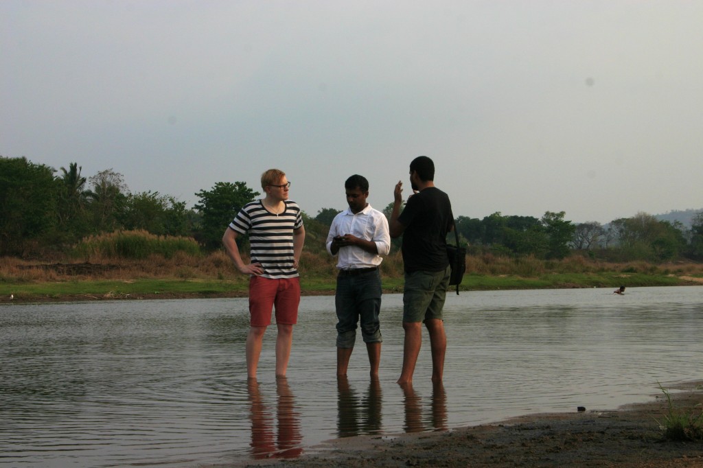
In March, GroundTruth went to Kerala, India at the invitation of The Blue Yonder, a “responsible tourism” outfit operating throughout India and based in Bangalore. Not knowing quite what to expect, we nonetheless jumped at the chance to work on a project about crowdsourcing the cultural history of the Nila River. Nila is one of the destinations that Blue Yonder knows best. Its founder, Gopinath Parayil, is a native of the area, which is in the northern part of Kerala state. Prakash Manhapra, another TBY staff, is a lifelong resident of Tirur, a city near Nila, and has absolutely encyclopedic knowledge of the region. Better yet, he has the curiosity of a journalist and an instinct for drawing out a fascinating tale from just about any bystander we came across.

Our task was to take a look at the wealth of cultural activity and history in the Nila basin, much of it very place-specific, and devise a methodology and training for turning this into an engaging multi-input platform for showing off the local riches. This all with a view toward drawing out elements for the tourist to seek out and enjoy, giving locals a chance to celebrate their heritage, while providing a means for preserving not only some of the more fragile customs and artistry but also the very river itself. Besieged by a long-running sand excavation, the “sand mafia” controls an often illegal but overlooked sand mining operation which is quickly destroying the ecosystem of the river linking the fascinating human settlements together over millennia. The hope of Blue Yonder was that the platform would help fight the environmental battle underway by reminding people how interlinked their lives were to this river.

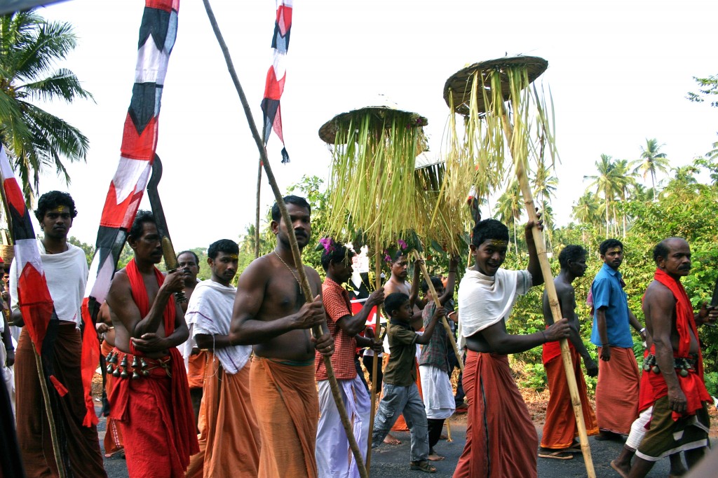
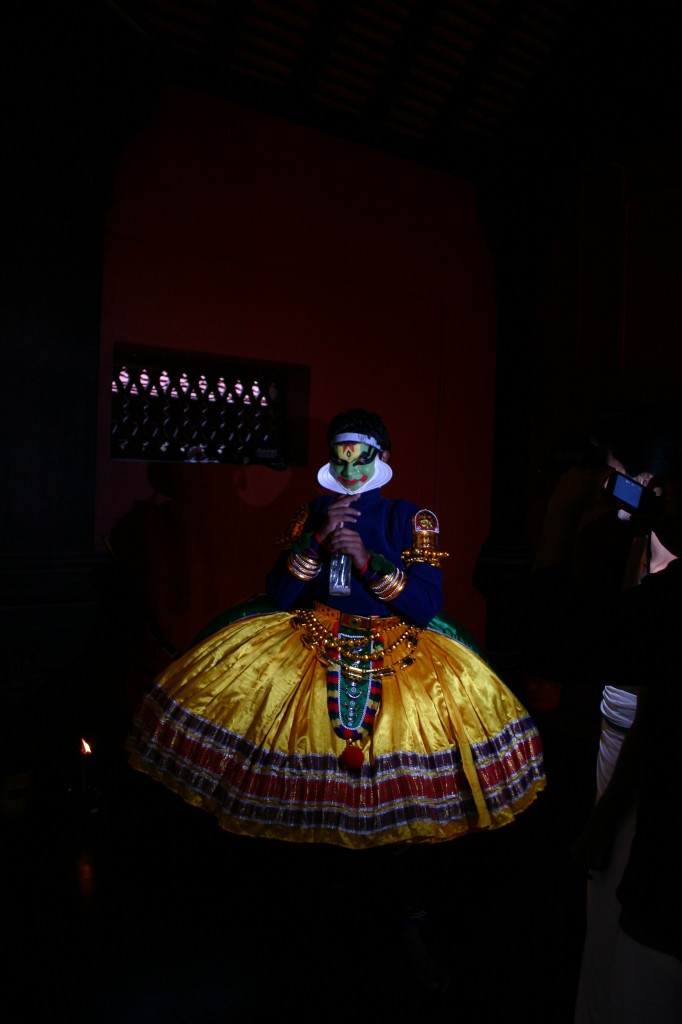
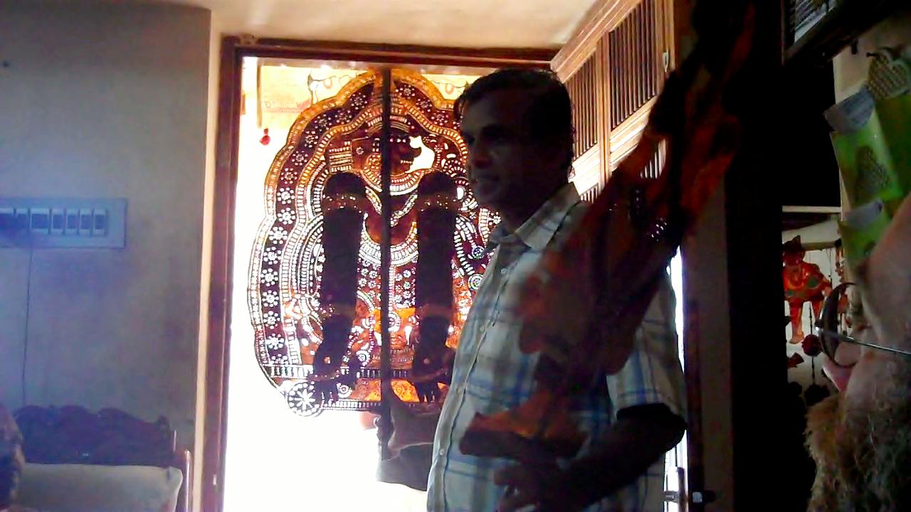
We took a welcome opportunity to use some of the same tools we’ve developed for slum residents to report on basic services and needs, Palestinian activists to share their efforts to retain their land, and Nigerians to share crime and security reports, to the more cheerful topic of highlighting a rich cultural heritage. And Nila has plenty of positive to share, as we discovered. We visited artisans making bell-metal puja sets, handweaving cloth, and throwing clay into cups and bowls in ways that reflected centuries-old traditions. We visited ayurvedic doctors, martial arts practitioners, traditional dance and Kathakali theater, even an all-night shadow puppet performance that is enacted for many nights in a row with or without audience, to please a watching goddess.

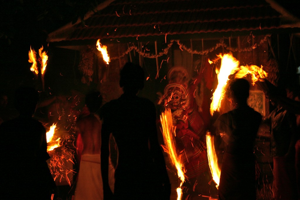
There was the unplanned too – we happened upon a tiny village festival featuring frightening fire-theatrics and elaborately made-up ritual performers channeling the snake deity. At another nighttime temple festival a band of drummers played relentlessly and ecstatically for hours until they stopped all together on a dime, leaving a haunting ring in the air for several seconds.


I also got to see elephants. Though some looked a bit sad.

Mesmerized as we were, we got down to business. Developing a system for recording some of these events would not be the challenge; even collecting media might be easy given that everywhere we went we saw cellphone photography and video in process. Kerala is not particularly poor; the historically communist-run state is proud of local development and a small fortune has been sent back from migrants overseas in the Gulf. Building a way for locals to interact would require, yes, a mapping of the area as well as a variety of ways to report through media and aggregate. We also wanted to involve the artisans somehow, so that they would receive more business, and integrate a social interface for recent visitors and tourists to submit media and interact with locals. Of course, the primary language in the area is Malayalam, complete with its own swirly script. Interaction with the site would have to be possible through Malayalam-enabled keyboards, Romanized inputs typically used with mobile phones, and English.

As usual, the wild card would be the community-level participants – who exactly would be energized to report, on what, and who would sustain the enthusiasm? Options included working with a fantastic local group Vayali, already dedicated to exhaustive cataloging of local culture for academic and other purposes, as well as a widespread project of youth engaged in a volunteer palliative care movement. These youth had the civic engagement spirit along with local knowledge. We could also access a mass-media outreach campaign to engage more contributors. Integration with social networking online was also important.

This project sparked a long-dormant passion of mine to preserve and protect traditional social and cultural practices which I believe are in similar (and related) peril to the ecosystems that are being systematically destroyed. There is an interrelation between the attention that one can focus on a cultural feature, and its survival in the face of immense economic and social pressure to conform to the dominant or “modern” culture.

Gopi showed us traditional Keralan architecture, which is being replaced, like everywhere, by cement block ugliness. I sometimes think of how the houses in my hometown were remodeled in the 1950’s to reflect the day’s mores, eliminating all the wood trim and tin ceilings. It’s only now that homeowners are trying to reconstruct what was damaged back then, which is never as good as the original. Gopi has convinced – sometimes by actually offering payment – some owners not to destroy but to preserve the traditional houses, by insisting that tourists would pay handsomely to stay in these beautiful lodgings. Running a tour company, he has some authority to make this claim. Examples of expensive “traditional” lodging abound, usually only as imitations. (Here’s a cool example of architectural preservation and tourism in Kathmandu).

Sometimes, locals do not realize that what they have always had – traditional architecture, artisanry and crafts, medicine and religious festivals – can be extremely valuable to the visitor as well. Of course, there is the danger that such practices will become museum-pieces for benefit of tourists alone. That is something we experienced in Kenya, where safari tours visiting colonial-style lodges will be presented with a song-and-dance performance abandoned by the actual representative tribe years ago. The effect was, for me, disturbingly patronizing. There’s nothing quite like seeing Kenyans dressed proudly in their costume on property once part of their spiritual homeland, in front of white haired foreigners supping on mashed potatoes and corned beef, in a lodge built by British colonials. But I digress.

The amazing thing about Kerala (and other parts of India) was that in no way was any of what we saw put on for our benefit, and yet, a visitor could still inspire pride and represent a financial incentive to support certain elements of culture. With our system, we hope to expand that experience to reporting oral history, heritage, cuisine, and other aspects of the river culture that make the place all that much richer. For example, there are archaeological remnants of an old trading route that tied into coastal shipping routes, pit-stops called Athaani that traders used to use for rest and refreshment, which we hope to map and annotate with interviews along the way. Only it won’t be us – as usual, only the community members will contribute, no outsiders, no researchers, no foreigners or even local city-folk. That kind of process, I hope, will lead to local ownership not only of this technology but also of the Nila itself.

Haiti Redux

This is an essay I wrote in 2006, after a trip to Haiti while working for Concern Worldwide. I recently came across it while digging up material for our upcoming trip there.

Haiti

I am on the Long Island Railroad, traveling through Queens, New York. On the side of a large gray building, I see these words printed, enigmatically: “Is it nothing to you, all you who pass by?” It has been less than 24 hours since I left Haiti, where I traveled for my job with Concern Worldwide to view our programs there in humanitarian relief. The words seem to be directed to me, the one who can move freely between worlds with such amazing speed

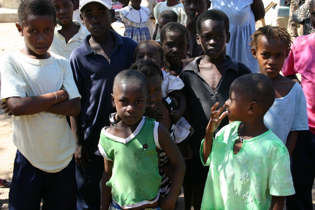
For I’ve done just that — passed by. Passed by misery and deprivation, past clusters of life and humanity I would not think could survive, like weeds pushing through the cracks of a sidewalk toward sunlight. Passed by in a whirlwind 72 hours, by train, plane, boat, four wheel drive. And I feel very much at the nexus, where one culture meets another, where rich meets poor, where gorgeous aquamarine waters meet crumbling concrete and open sewers, where human meets nature in a sometimes losing battle to reap survival out of the dust.

As for the answer to the question – no, it is not nothing to me. In fact, it has affected me profoundly, unexpectedly, even, since I’ve traveled before – but I suppose I had forgotten.

Haiti2006 308

For humans rely on an entire universe of support to keep them alive. This was what I was continually reminded of in Haiti. An oft-heard religious phrase was mentioned by someone on the trip: “There but for the grace of God go I.” Each individual is stationed atop an endless network of linked hands, without which we fall prey to the unpredictable whims of nature. One day, food comes through the cracked, dry earth, and grows, and we are fed and we are happy. Another day, the rain has not fallen and the earth finally stops producing its green nurturance, and we are starved. Every day is a trust fall: you know, the old exercise often practiced at ropes courses and summer camps, where a group of fellow campers links hands and forms a net, and you stand atop a platform near their heads, and fall straight backwards. The jarring rush of fear that comes right as you lean back and cross the point of no return, right as you know – for certain – that your physical well-being rests with these people – friends, enemies, strangers – to catch you before you hit the ground. Will they be there? Never quite sure, you must summon every ounce of trust, blind trust and pure courage.

It must be this trust that keeps the Haitian people going, I think. But in fact, who are they trusting? Who can possibly be there to catch the fallout of humanity, in a place where every man and woman must daily confront the basic questions of survival: where will my family’s next meal come from? Where will our water come from? Where will I throw my trash, where will I go to the toilet? Of course, after years of living with these questions, there are a few answers: I will perhaps sell a few ounces of charcoal that I make by cutting down the few trees that remain. My daughter will walk for an hour, or two or three, to fetch a few liters of water for the whole family. I will eat mangos off the tree and perhaps not much else all day. The trash goes into the stinking ditch inches from my house, and the latrine is up the street and shared with all the families of the neighborhood; otherwise the canal is another option. Where are the hands of the receivers, the linked hands of humanity waiting to catch me? I fear I have already fallen too far.

Haiti2006 101

I did not expect to find that the Concern staff – mostly Haitian, with one American, a Belgian, some Irish – are the very ropes of the safety net itself for so many Haitians. I am not sure what I expected. Perhaps a health clinic here, a well there. I did not realize the scope of the projects undertaken on the island. I was impressed by the linkages with the local partners, regular folk living in these communities, who have stepped forward and decided to group together and try to solve some of these problems. Who have chosen, of their own accord, to be the safety net for others, to lift up their fellow humans on their own shoulders. In Haiti, it is quite clear where these relationships exist, and how.

Father Aengus Finucane, who traveled with me and who founded Concern in 1968, said during the trip that one of the first things he learned while studying political science is that “Man is a political animal. Anywhere, he will organize.” I understood what he meant while talking to some residents of the tiny island of La Gonave, which last year suffered through 7 months of drought. These residents had proudly joined together with Concern representatives and the island’s mayor to build and manage several water cisterns and wells. One man had spent several days traveling, often on foot and without a road in sight, throughout the island to ask where and how people were collecting water. He said that they often walk down the mountain, with a donkey if they are lucky, load up some buckets and walk back. The whole process can take the better part of a day, and the task usually falls to one of the women or girls of the family.

With Concern providing things like building materials and payment for workers, along with a full time water coordinator, the water committee had built a few concrete cisterns to hold rainwater, helping some residents cut back on their water trekking time. Concern had also advised them about the benefits of using a chlorine solution to kill off bacteria. But if a community does not link hands like this and provide a net, such structures will fall into disrepair, the message about the chlorine treatment won’t stick, and the next thing you know the process has to be started up all over again. It is this type of building, rather than the physical building, which is crucial. Concern’s staff in Haiti are very aware of this, and months of careful relationship-building went into the cistern project until everyone involved was personally invested in its success. It is a delicate, often frustrating process of consensus building, of trust-building. The nuts and bolts of linking together – you have some of this, I have some of that, and together we can make something happen.

Haiti2006 129

Having just seen this basic level of development in its slow, confounding, messy, but ever hopeful process, it has become so clear to me the extent to which we Americans stand on millions, billions of shoulders. We are not here by accident. We have climbed here. Having seen them all my life, skyscrapers suddenly surprise me; Manhattan – who built it? How did it come to pass that these sturdy buildings cropped up here, instead of the crumbling “architecture of poverty” (as one of my fellow travelers called it) in Haiti and other developing countries? Of course, it was the hands of millions – providing the money, the manpower, the materials, the plans, the land – that made it possible to hoist them so high.

I arrive on Long Island, where I’m visiting relatives. My cousin and his wife are there with their toddler. Five adults are caring for the child, who has four highchairs (one for each grandparent and her own house) and countless shiny new toys. She is beautiful, innocent. I do not begrudge her the care, love, and small baby luxuries that any parent would likely give her child if she was able. But I can’t help but imagine how many layers of hands, holding together, form the thick net of safety which holds this child firmly. Invisible fingers, which by chance entwined to lift this young baby up to cloud height, where she may freely wander, and see out over the horizon. While many a Haitian baby plays in the dirt between two tall, cinderblock walls, a sliver of sky barely visible above. I write this because I am amazed, not because I am angry. I am amazed that we do not see life. We do not see the generations of luck, hard work, failure and success that culminate in each of our very existence.

I am paging through an album at my uncle’s house, which he recently made from artifacts that were discovered in my grandmother’s apartment when she passed away. They are old, old photographs, my grandma’s grandma, articles about the life of my great-grandfather, birth certificates, records of generations past. It is all right there, the legacy that has come to result in these walls around me, to produce the toddler who can want for nothing. That have culminated in my own life. And I do not know how I can explain what I have seen, how I have passed by and how it’s not nothing to me, how I know I cannot just be a passerby. My relatives ask me, How was Haiti? I say that it was amazing, intense, difficult, interesting, beautiful. The conversation moves on – local business deals, plans for the day.

I suppose that all I want to ask is that you see the hands of millions that have graciously sculpted your life of opportunity. And that you not feel guilty, although some of the hands have been shackled, and some have bled, and most have suffered. I only ask that you see them, and are grateful for your life, and give freely from that which has been given to you. And at times when you are asked for a drink of water, you jump at the chance to say thank you to this person, your patron. Your safety net. Your great-great-grandmother.

Twitter Weekly Updates for 2010-08-22

  • “the age 30 deadline.” oops! missed it. #
  • However, "Safaricom Chief Executive Officer Michael Joesph said price wars are no longer fashionable in Kenya." Let's get the new CEO in. #
  • "Zain will now charge only a shilling for an sms." Finally, some price drops! Maybe I'll switch 🙂 #
  • Just don't feel like it today. #
  • Finally back from a ridiculous camel derby in Samburu territory. Strange to be a clown… I guess it serves us mzungus right. #

Twitter Weekly Updates for 2010-08-08